


Underhill Voting District, Chittenden County, Vermont
About
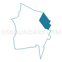
Outline

Summary
| Unique Area Identifier | 680746 |
| Name | Underhill Voting District |
| County | Chittenden County |
| State | Vermont |
| Area (square miles) | 51.40 |
| Land Area (square miles) | 51.33 |
| Water Area (square miles) | 0.07 |
| % of Land Area | 99.86 |
| % of Water Area | 0.14 |
| Latitude of the Internal Point | 44.54236720 |
| Longtitude of the Internal Point | -72.88322620 |
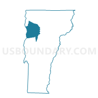
Maps

Graphs
Select a template below for downloading or customizing gragh for Underhill Voting District, Chittenden County, Vermont


Neighbors
Neighoring Voting District (by Name) Neighboring Voting District on the Map
- Bolton Voting District, Chittenden County, VT
- Cambridge Voting District, Lamoille County, VT
- Essex District 2, Chittenden County, VT
- Jericho Voting District, Chittenden County, VT
- Stowe Voting District, Lamoille County, VT
- Westford Voting District, Chittenden County, VT
Top 10 Neighboring County Subdivision (by Population) Neighboring County Subdivision on the Map
- Essex town, Chittenden County, VT (19,587)
- Jericho town, Chittenden County, VT (5,009)
- Stowe town, Lamoille County, VT (4,314)
- Cambridge town, Lamoille County, VT (3,659)
- Underhill town, Chittenden County, VT (3,016)
- Westford town, Chittenden County, VT (2,029)
- Bolton town, Chittenden County, VT (1,182)
Top 10 Neighboring Elementary School District (by Population) Neighboring Elementary School District on the Map
- Essex Town School District, VT (10,311)
- Jericho School District, VT (3,807)
- Cambridge School District, VT (3,659)
- Underhill Town School District, VT (2,347)
- Westford School District, VT (2,029)
- Underhill Incorporated School District, VT (1,871)
- Bolton School District, VT (1,182)
Top 10 Neighboring Secondary School District (by Population) Neighboring Secondary School District on the Map
- Essex Community Education Center, VT (19,587)
- Mount Mansfield Union School District 17, VT (15,226)
- Lamoille Union High School District 18, VT (12,403)
Top 10 Neighboring Unified School District (by Population) Neighboring Unified School District on the Map
Top 10 Neighboring State Legislative District Lower Chamber (by Population) Neighboring State Legislative District Lower Chamber on the Map
- Chittenden-8 State House District, VT (9,207)
- Lamoille-4 State House District, VT (4,680)
- Chittenden-6-3 State House District, VT (4,331)
- Lamoille-1 State House District, VT (4,314)
Top 10 Neighboring State Legislative District Upper Chamber (by Population) Neighboring State Legislative District Upper Chamber on the Map
Top 10 Neighboring 111th Congressional District (by Population) Neighboring 111th Congressional District on the Map
Top 10 Neighboring Census Tract (by Population) Neighboring Census Tract on the Map
- Census Tract 29, Chittenden County, VT (6,227)
- Census Tract 28, Chittenden County, VT (5,009)
- Census Tract 27.02, Chittenden County, VT (4,935)
- Census Tract 9536, Lamoille County, VT (4,314)
- Census Tract 9531, Lamoille County, VT (3,659)
Top 10 Neighboring 5-Digit ZIP Code Tabulation Area (by Population) Neighboring 5-Digit ZIP Code Tabulation Area on the Map
- 05452, VT (19,710)
- 05465, VT (5,355)
- 05477, VT (4,397)
- 05672, VT (4,314)
- 05489, VT (3,174)
- 05464, VT (3,008)
- 05494, VT (1,767)
- 05444, VT (1,714)